
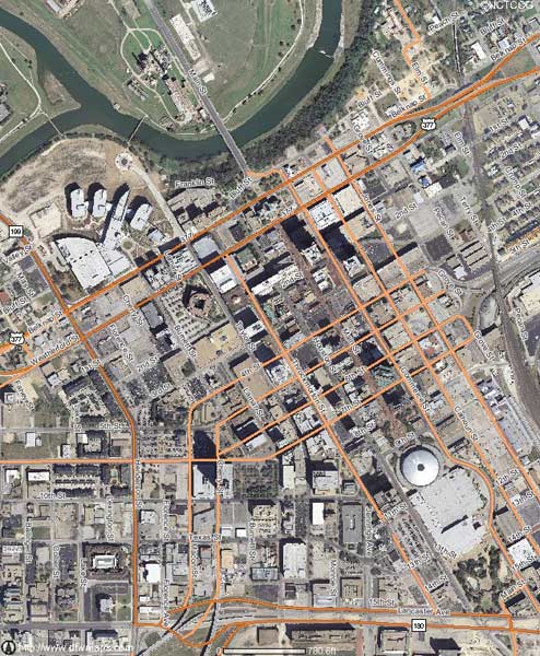
Why don't you take one of your existing downtown maps and colorize it to show who owns what. I'm thinking mainly of the Bass/Sundance properties and XTO energy. Here is a map, that made me think of this after I was talking with Dad.
Later, Bryan


Member

Posted 08 September 2007 - 08:46 AM
Skyscraper Member

Posted 08 September 2007 - 01:22 PM

Better Business Bureau: A place to find or post valid complaints for auto delerships and maintenance facilities. (New Features) If you have a valid gripe about auto dealerships, this is the place to voice it.
Member
Posted 09 September 2007 - 02:35 PM
Skyscraper Member

Posted 10 September 2007 - 07:30 AM
Dave still at
Visit 360texas.com
Skyscraper Member

Posted 10 September 2007 - 10:52 AM


0 members, 1 guests, 0 anonymous users

