Jump to content


Photo
- - - - -

The "Bomber" Railroad Spur


  • Please log in to reply
110 replies to this topic

#1 Giraffe

Giraffe

    Member

  • Members
  • PipPipPip
  • 181 posts

Posted 13 April 2008 - 09:18 AM

Thanks to a great website called www.abandonedrails.com, I've finally solved a minor mystery that's been plaguing me for decades. It has to do with a railroad on the west side of Fort Worth.

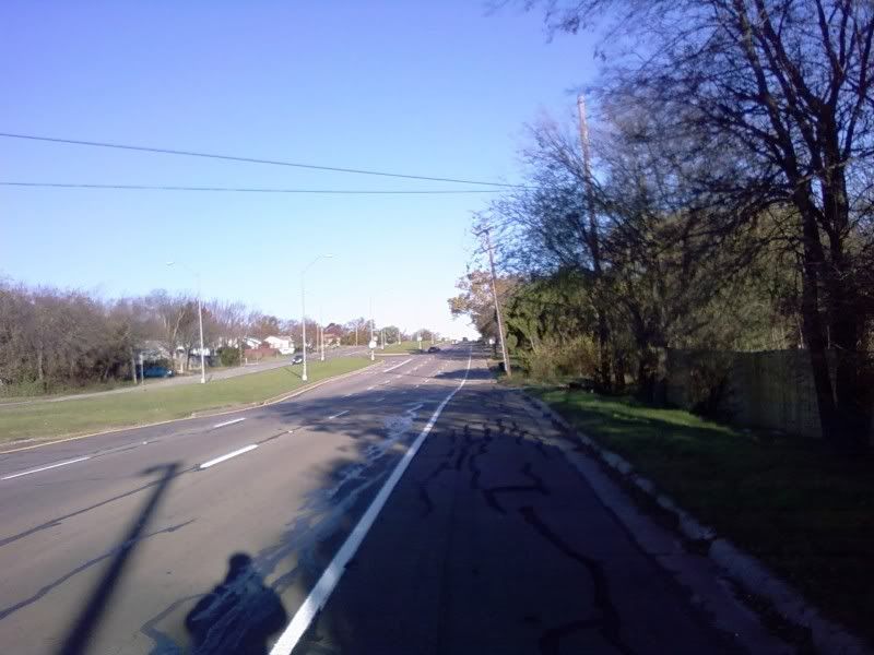
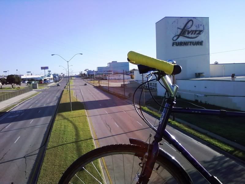
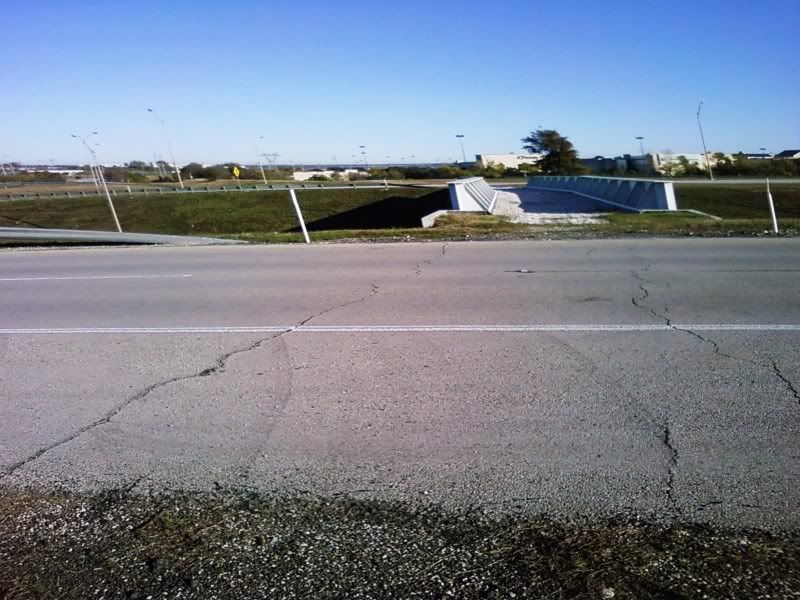
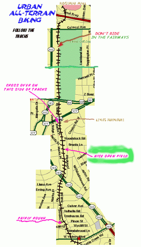
You may recall that the southwestern quadrant of Loop 820 was the last chunk of the loop to be completed, and throughout the '70s and early '80s the only way to get from the Hulen Mall area to the western part of town was via State Highway 183. That SH183 sorta became a busy street once you got west of Vickery, with plenty of houses and businesses right on the shoulder as you got closer to the Traffic Circle. And a railroad crossed the roadbed! You don't see that on Interstates. smile.gif I do recall having to wait for a train to pass a few times long ago, but as the years passed I saw less and less activity on that line. I always wondered what that rail line was for, who used it, etc. Then a few years ago I discovered that the rails had been totally removed! I had seen those rails getting twisted and uneven with time, telling me that they had not been maintained of late and probably had not seen a train for ages.

A guy I used to work with grew up in that neighborhood and he told me that he actually hitched a ride on a train on that line when he was barely five years old. It went right past his backyard and it was moving slowly enough that he could just climb on a boxcar and have a fun ride. As you may guess, the train sped up a little and he was too scared to jump off, so he just hung on for dear life and waited. The train, he said, was a supply train for Carswell Air Force Base and he rode that thing all the way into it. It didn't take long for the military police guys to see him and grab him. Gary, of course, was frightened to death as it was. But it got even better because his father was a supply sergeant at Carswell!!!! Gary, little kid that he was, gave them his name as well as that of his father, some phone calls were made, and Gary said they threw him into a cell until his father could take him home. (Gary said later that the cops had done so at his father's behest, in order to purposely scare the fecal matter out of him.) I'm sure Sergeant Dad had some fine words to live by for him later that day, too! smile.gif

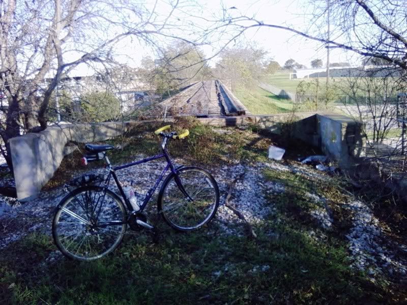
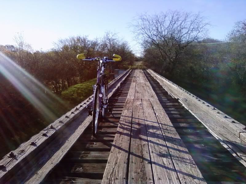
Gary has since passed away, but when he told me this story I wasn't quite sure he was telling me the 100% truth. I had no idea where that rail line really went, as I didn't live in that neighborhood. But after just casually looking through abandonedrails.com, I found out that Gary was right! It really was a supply line for both Carswell and General Dynamics! It was a five-mile spur that came off a major rail line that ran next to Vickery, and the spur was built around World War II to provide raw materials to the bomber plant at G.D., as well as fuel for the airplanes at the Air Force base. But as the years went by, more material was shipped into the plant by truck, and a pipeline was installed for providing jet fuel. That led to the decline of the rail spur (which was actually called "Bomber," according to signs posted along that route). Gary said it was sorta/kinda kept as an emergency "derail" line in case of a runaway train, but I don't know if it ever had to be used that way.

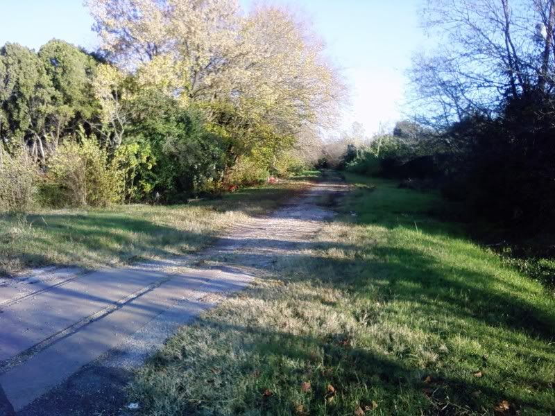
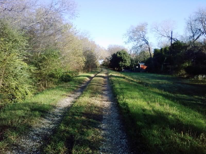
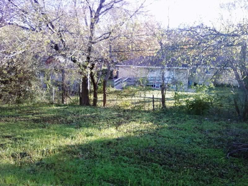
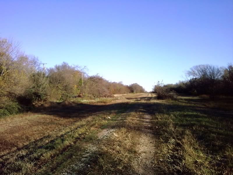
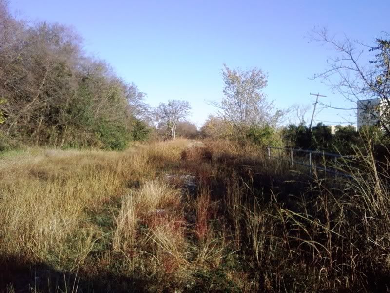
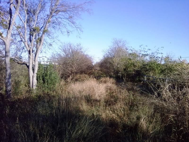
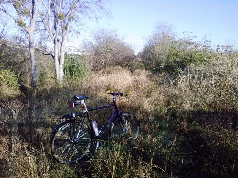
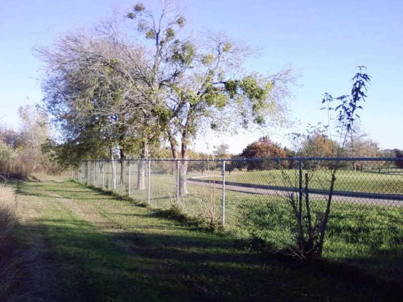
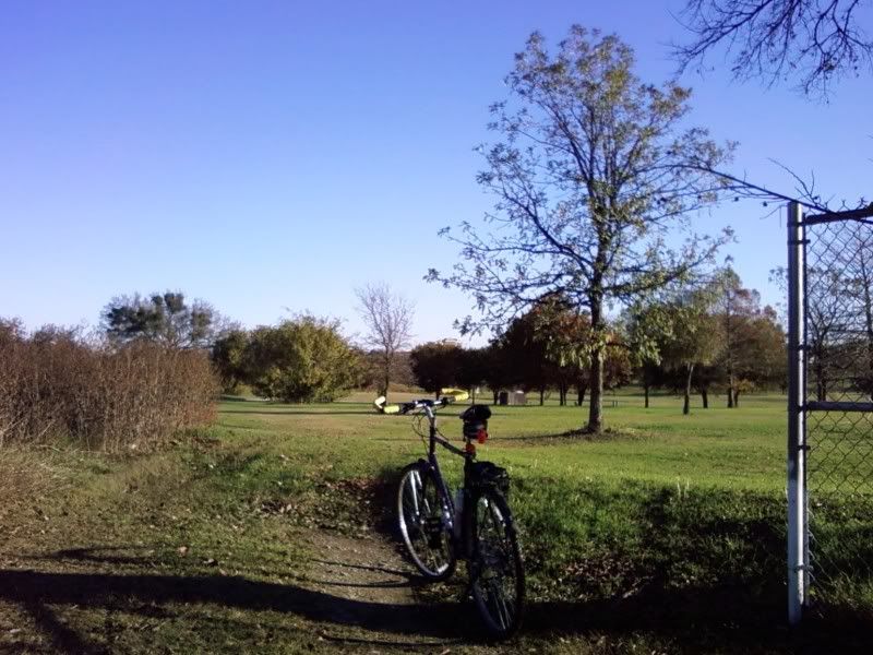
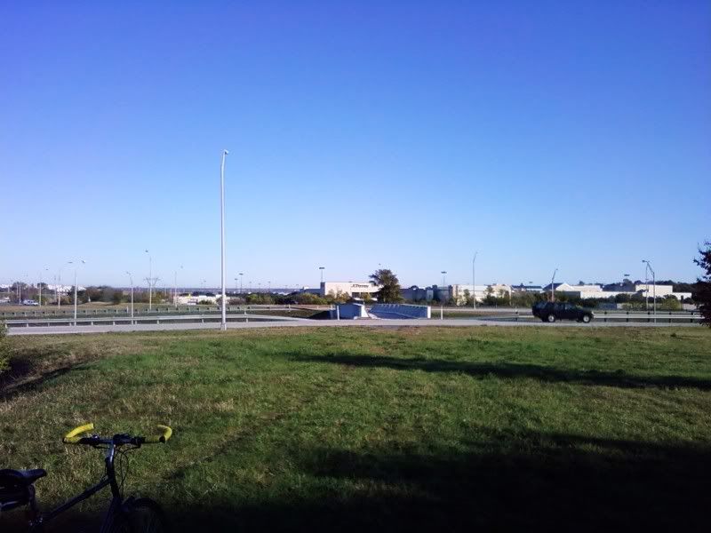
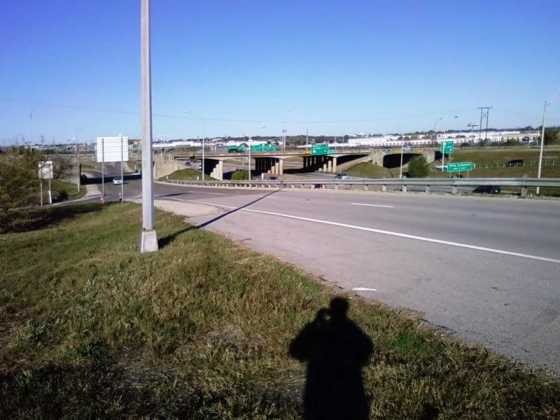
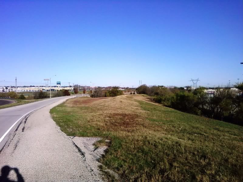
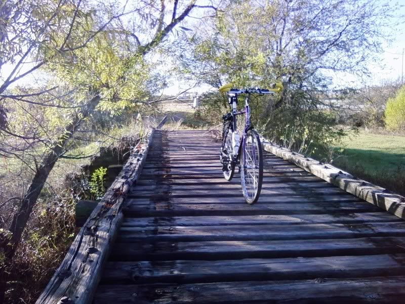
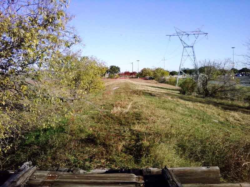
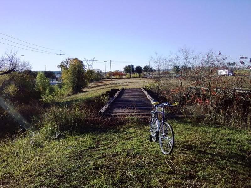
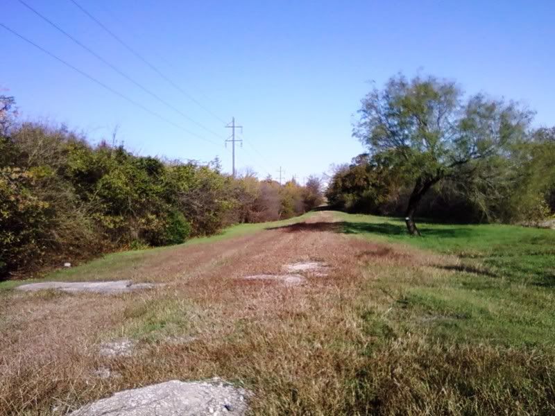
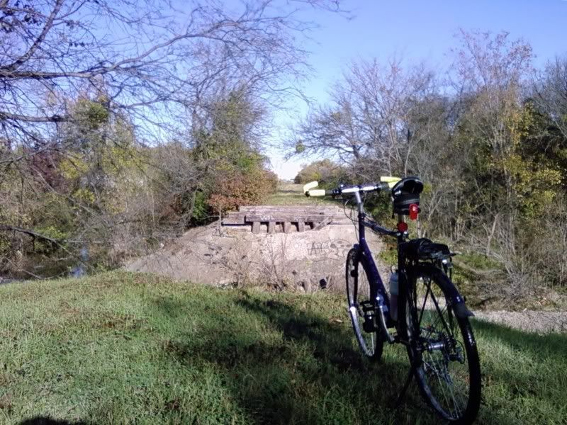
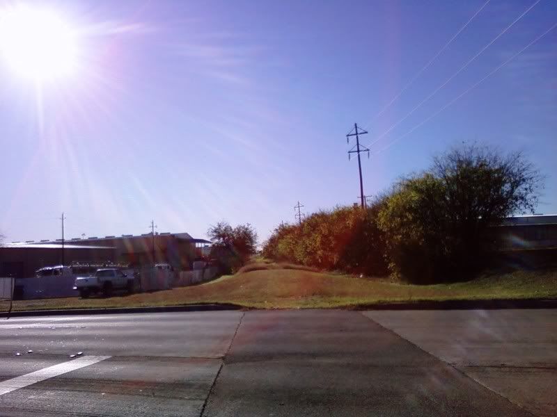
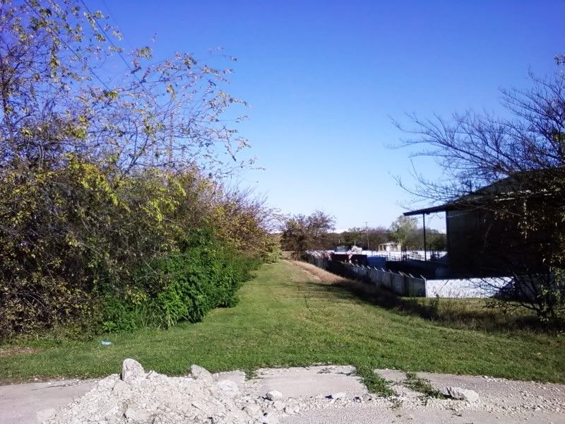
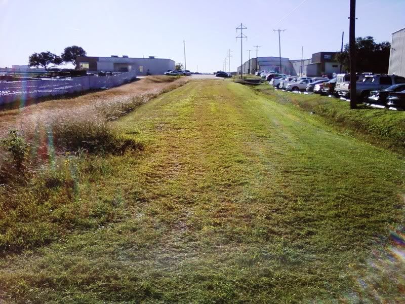
Even though the rails have been removed, you can still easily see the right of way for this spur today on satellite photographs. After peeling off at Vickery, it crossed 183, Camp Bowie, I-30, and right into Carswell/G.D. You can see where some of the overpasses were. This website has some good photographs of this route, as well as other abandoned rail lines elsewhere in Fort Worth and all over the rest of the country.

I don't think the site covers this, but I do remember a short line crossing over I-30 on its own bridge, ending next to the Ben Hogan plant at Montgomery Street (behind the Botanic Gardens). That line has since been totally removed, and so has that bridge. The Ben Hogan building is now an antique fair.

#2 Ghost Writer in Disguise

Ghost Writer in Disguise

    Senior Member

  • Members
  • PipPipPipPip
  • 335 posts
  • Gender:Male
  • Location:Ridglea West

Posted 13 April 2008 - 02:10 PM

Ah, the Bomber Spur. Built in 1941, dismantled in early 2001. In 1984 a semi trailer on the west freeway took out the bridge there and even though it was replaced - twice, in fact - the spur was never used again. Soon after this a fuel pipeline to Carswell went into service and there was no longer a need for the long strings of tank cars that had been hauled thither. For a good many years thereafter one could drive past GD where the tracks entered and still see their forlorn GE 44 ton locomotive inside the fence. I guess they finally hauled it out on a truck.

As a tiny tot I lived on Marks Place and it was always a thrill to look out back and see the morning train to Carswell and Convair behind a back-to-back pair of blue & gray T&P F7s. God I miss them.

The track by Ben Hogan's connected the T&P with the Frisco. It met with the latter south of W 7th. I remember that it ran down the middle of Kimzey.

#3 safly

safly

    Skyscraper Member

  • Members
  • PipPipPipPipPipPipPip
  • 4,069 posts
  • Gender:Male
  • Location:ALAMO!
  • Interests:Restaurants. Golf. Garlic. FIESTA. Beer ME.

Posted 13 April 2008 - 02:16 PM

Neat story tellin.
Glad I "clicked" on to the topic.

Seems like you two have plenty to tell about FW's unique modern history.
COWTOWN! Get your TIP ON!
www.iheartfw.com

#4 RD Milhollin

RD Milhollin

    Member

  • Members
  • PipPipPipPipPipPipPip
  • 2,945 posts
  • Gender:Male
  • Location:Las Vegas, NV

Posted 14 April 2008 - 08:11 AM

Looks like this spur could be a candidate for passenger commuter rail in the future. The Westside line could start at the Intermodal Station (can't we get a better name for that???) and the T&P Station downtown, continue to a station between Rogers and University Drive, continue on track paralleling UP ROW alongside the Lancaster Yards in Westside to stations under the Hulen and Bryant Irvin Bridges, another at Vickery and SH 183, then enter the abandoned spur and end up with a station at Ridgmar Mall and terminate at the gate of Lockheed. A company bus could speed workers to their buildings once past security.

Oops, should this have gone in the Transportation Section Andy?

#5 lens314

lens314

    Member

  • Members
  • PipPipPip
  • 92 posts
  • Gender:Male
  • Location:North Fort Worth
  • Interests:Airplanes, Cars, Computers, LEGO

Posted 14 April 2008 - 08:47 AM

Cool thread, and cool link to the abandoned railroads site.
I've always wondered about the track into the GD/LM side, since I cross the grade to go to work.

QUOTE (Prairie Pup @ Apr 14 2008, 09:11 AM) <{POST_SNAPBACK}>
Looks like this spur could be a candidate for passenger commuter rail in the future. The Westside line could start at the Intermodal Station (can't we get a better name for that???) and the T&P Station downtown, continue to a station between Rogers and University Drive, continue on track paralleling UP ROW alongside the Lancaster Yards in Westside to stations under the Hulen and Bryant Irvin Bridges, another at Vickery and SH 183, then enter the abandoned spur and end up with a station at Ridgmar Mall and terminate at the gate of Lockheed. A company bus could speed workers to their buildings once past security.

Oops, should this have gone in the Transportation Section Andy?


Put in a station in the Fossil Creek area and sign me up!


-Doug

#6 mmiller2002

mmiller2002

    Elite Member

  • Members
  • PipPipPipPipPipPip
  • 965 posts
  • Gender:Male
  • Location:North Hi Mounttttt
  • Interests:Born 1959
    HS Grad 1977
    1982 BSEE Penn State

Posted 14 April 2008 - 12:25 PM

I think that this is the line you are describing:

http://www.webpages4...iking/uatb1.htm

#7 Ghost Writer in Disguise

Ghost Writer in Disguise

    Senior Member

  • Members
  • PipPipPipPip
  • 335 posts
  • Gender:Male
  • Location:Ridglea West

Posted 14 April 2008 - 11:27 PM

Here's another West Side railroad mystery: years ago I was at the Central Library poring over the FW Geological Society aerial photograph of town circa mid 1950s. Near Benbrook I saw the distinct trace of a railroad grade switching from the T&P track toward 377. It faded to nothing before getting that far and there was no longer a trestle where it crossed Walnut Creek so I knew it had been abandoned even then. I also knew that the grade where the trestle had been would still be there so I undertook to find it one afternoon. I parked at the end of Mercedes and shlepped westward, not sure of which way to go but following the ruts in the gravel. I passed a curious little white building as I wound through the woods and across the creek and presently I found what I sought: the unmistakable earthwork of a long-vanished railroad bridge, well-rutted by years of dirt-biking. I looked around for remnants of wooden pilings but found none. I did, however, find an actual piece of rail near the top and made a mental note to come back for it. I followed the grade westward till the mesquites made it impassable and invisible and then I turned back. The less said about my effort at blazing my own trail, the better, but I cussed myself for not bringing a machete. I guess that wouldn't have been legal, though.

I was more mystified than ever. Why on earth was there a railroad spur into Benbrook, and when was it there, and why was it gone by the mid 50s? By and by, the answer came to me with the help of some local history articles and photographs in some now defunct Benbrook weekly papers. It was the spur that served Carruthers Field during World War One, and the white structure was the ammunition storage building. It was, along with the railroad grade, all that was left. And even it is gone now. That area is under development, and I read in the S-T a few years ago that the ammo building was a casualty. Luckily I had gone back later and got a few pctures of it. Somebody else had beaten me to that piece of rail, though...


#8 Thurman52

Thurman52

    Skyscraper Member

  • Members
  • PipPipPipPipPipPipPip
  • 1,181 posts
  • Gender:Male
  • Location:Edwards Ranch

Posted 15 April 2008 - 05:40 AM

QUOTE (mmiller2002 @ Apr 14 2008, 01:25 PM) <{POST_SNAPBACK}>
I think that this is the line you are describing:

http://www.webpages4...iking/uatb1.htm


I have been wondering if we could use some fed funding and turn that old RR into a trail system. I believe there is a rails to trails funding from the transportation department.


#9 AndyN

AndyN

    Skyscraper Member

  • Moderators
  • PipPipPipPipPipPipPip
  • 2,280 posts
  • Gender:Male
  • Location:Downtown Fort Worth

Posted 15 April 2008 - 06:50 AM

I bet Union Pacific would be happy to sell it to you for hike & bike trail. I can only guess their asking price. Biking on the right-of-way is technically trespassing on private property, but it seems they would have a hard time enforcing that.
Www.fortwortharchitecture.com

#10 Ghost Writer in Disguise

Ghost Writer in Disguise

    Senior Member

  • Members
  • PipPipPipPip
  • 335 posts
  • Gender:Male
  • Location:Ridglea West

Posted 15 April 2008 - 09:32 AM

QUOTE (AndyN @ Apr 15 2008, 07:50 AM) <{POST_SNAPBACK}>
I bet Union Pacific would be happy to sell it to you for hike & bike trail. I can only guess their asking price. Biking on the right-of-way is technically trespassing on private property, but it seems they would have a hard time enforcing that.

From everything that I hear it has always been USAF property.

#11 GenE

GenE

    Member

  • Members
  • PipPipPip
  • 147 posts
  • Gender:Female
  • Location:Austin, TX
  • Interests:History, photography,

Posted 15 April 2008 - 07:41 PM

QUOTE (Giraffe @ Apr 13 2008, 10:18 AM) <{POST_SNAPBACK}>
Thanks to a great website called www.abandonedrails.com, I've finally solved a minor mystery that's been plaguing me for decades. It has to do with a railroad on the west side of Fort Worth.


The train, he said, was a supply train for Carswell Air Force Base and he rode that thing all the way into it.

That led to the decline of the rail spur (which was actually called "Bomber," according to signs posted along that route).


Don't know if I was naive or not, but around '78-79 before my daughter was born, I worked at Homers (on Hulen) with an airman stationed at Carswell. I remember that he told me that if I ever saw movement on that track, it would be bombs, and would mean that we were probably at war. Funny thing is, shortly after dau was born, we had the first Iranian (I think) crisis....and I was panicked for months thinking that I had brought a defenseless baby into a world that was going through kidnappings and bombings.

I still don't know, maybe he was just feeding my 25 year old immaturity/paranoia.

GenE

#12 AndyN

AndyN

    Skyscraper Member

  • Moderators
  • PipPipPipPipPipPipPip
  • 2,280 posts
  • Gender:Male
  • Location:Downtown Fort Worth

Posted 16 April 2008 - 01:38 PM

QUOTE (Ghost Writer in Disguise @ Apr 15 2008, 09:32 AM) <{POST_SNAPBACK}>
From everything that I hear it has always been USAF property.


I imagine that the feds own the right-of-way inside the fenceline of the base, but according to the Tarrant Appraisal District, the line is owned by the successor to the Texas Pacific, Missouri Pacific, which was bought out by Union Pacific.
Www.fortwortharchitecture.com

#13 Jamie

Jamie

    Member

  • Members
  • PipPipPip
  • 64 posts

Posted 16 April 2008 - 04:07 PM

QUOTE (Prairie Pup @ Apr 14 2008, 08:11 AM) <{POST_SNAPBACK}>
Looks like this spur could be a candidate for passenger commuter rail in the future. The Westside line could start at the Intermodal Station (can't we get a better name for that???) and the T&P Station downtown, continue to a station between Rogers and University Drive, continue on track paralleling UP ROW alongside the Lancaster Yards in Westside to stations under the Hulen and Bryant Irvin Bridges, another at Vickery and SH 183, then enter the abandoned spur and end up with a station at Ridgmar Mall and terminate at the gate of Lockheed. A company bus could speed workers to their buildings once past security.


At the last Mobility and Air Quality focus group meeting I attended back in December, the Fort Worth planning department had a map that identified the portion of Bomber Spur between Ridgmar Mall and Camp Bowie as one of two "transit corridors" under consideration (the other being Richland Hills TRE to Lancaster along Loop 820). I asked what this meant and they told me to follow-up with an e-mail which I did. Here is the response:
"We modeled the connection between these two locations to forecast ridership potential. Currently modeling is showing a rapid transit alignment between these two locations is warranted based on ridership."
This doesn't say much, but conversations to various people at The T lead me to believe Bus Rapid Transit is their preferred option at this point.

BTW, I think the Intermodal Station should be called by it's originally planned name: "9th Street Station".


#14 ALotech

ALotech

    Newcomer

  • Members
  • Pip
  • 10 posts

Posted 10 June 2009 - 08:57 PM

Bomber run came in off the tracks off of W. Vickery. It crossed Vickery at the FW/BB limit and snake through the neighborhood. Cross SW Blvd and make its way up to the west frwy. Traffic on the service road would have to stop for the train, as it crossed over the bridge over the frwy. It went up along the west side of Ridgmar Mall and about halfway by the mall was a switch. The train going to Carswell would continue straight and the supply train to GD would go left. It crossed spur 341 and continued into the gate on Clifford. The tracks at the plant are still there. The scary part was you had all these tankers of jet fuel and cancerous material right in you back yard had there been an accident or fire. The switch on the tracks off of Vickery is still there and still has the bomber sign on it. The tracks that used to be by Montgomery st was to supply Bell Helicopter when it was there. You will notice that there are not any dock doors at Ben Hogan.

#15 Akuhead

Akuhead

    Newcomer

  • Members
  • Pip
  • 9 posts
  • Gender:Male
  • Location:Ridglea Hills
  • Interests:Old Fort Worth, 1950s/60s Hawaii

Posted 11 June 2009 - 08:57 PM

I've always wondered about the two abandoned RR trestles along SH183 in front of Ridgmar Mall. Now I know what they were used for. Great thread, thanks!

#16 Ghost Writer in Disguise

Ghost Writer in Disguise

    Senior Member

  • Members
  • PipPipPipPip
  • 335 posts
  • Gender:Male
  • Location:Ridglea West

Posted 11 June 2009 - 10:30 PM

QUOTE (ALotech @ Jun 10 2009, 09:57 PM) <{POST_SNAPBACK}>
The switch on the tracks off of Vickery is still there and still has the bomber sign on it.


If you go up to that switch today and look down between the rails you can still find the initials "T&P" and the year "1941".

#17 Ghost Writer in Disguise

Ghost Writer in Disguise

    Senior Member

  • Members
  • PipPipPipPip
  • 335 posts
  • Gender:Male
  • Location:Ridglea West

Posted 02 July 2009 - 09:43 PM

QUOTE (ALotech @ Jun 10 2009, 09:57 PM) <{POST_SNAPBACK}>
Cross SW Blvd and make its way up to the west frwy... The scary part was you had all these tankers of jet fuel and cancerous material right in you back yard had there been an accident or fire.

Just remembered: in 1977 there was a truck/train collision at Southwest Blvd. I don't remember if the driver was killed. Firefighters from Carswell were called to the scene — I guess the worst was expected but there was no evacuation. The train was on its way to the base so it can be presumed the tank cars were full. Later it was disclosed that the box car(s) were laden with small arms ammunition.

#18 Ghost Writer in Disguise

Ghost Writer in Disguise

    Senior Member

  • Members
  • PipPipPipPip
  • 335 posts
  • Gender:Male
  • Location:Ridglea West

Posted 19 November 2009 - 09:22 PM

QUOTE (Ghost Writer in Disguise @ Jun 11 2009, 10:30 PM) <{POST_SNAPBACK}>
QUOTE (ALotech @ Jun 10 2009, 09:57 PM) <{POST_SNAPBACK}>
The switch on the tracks off of Vickery is still there and still has the bomber sign on it.


If you go up to that switch today and look down between the rails you can still find the initials "T&P" and the year "1941".


Well, not anymore. They just dismantled that siding this week.

#19 Doohickie

Doohickie

    Skyscraper Member

  • Members
  • PipPipPipPipPipPipPip
  • 5,029 posts
  • Gender:Male
  • Location:South Hills

Posted 21 November 2009 - 10:31 PM

Interesting discussion. I may be able to use the old Carswell rail line as part of my bike commute. In fact it would make a super-cool rails-to-trails route from Vickery to Ridgmar Mall and even into the Lockheed plant.
My blog: Doohickie

#20 Doohickie

Doohickie

    Skyscraper Member

  • Members
  • PipPipPipPipPipPipPip
  • 5,029 posts
  • Gender:Male
  • Location:South Hills

Posted 25 November 2009 - 12:32 PM

I rode the spur this morning from the Southwest Blvd. crossing almost all the way into Lockheed. I took several pictures; I'll get them up later. Right now I'm pooped.
My blog: Doohickie

#21 Thurman52

Thurman52

    Skyscraper Member

  • Members
  • PipPipPipPipPipPipPip
  • 1,181 posts
  • Gender:Male
  • Location:Edwards Ranch

Posted 25 November 2009 - 03:43 PM

I like the idea of rails to trails program how does that get started? Anyway we can connect it into the trinty trails system?

#22 Doohickie

Doohickie

    Skyscraper Member

  • Members
  • PipPipPipPipPipPipPip
  • 5,029 posts
  • Gender:Male
  • Location:South Hills

Posted 25 November 2009 - 04:59 PM

I have no idea either. Here is the route I rode. I actually rode Bellaire to the Trinity Trail at 183, got off on 183 and followed it up to the starting point. There is an additional section of the trail that runs from where the spur leaves the mainline at Vickery and runs from there to the point on 183 where I picked it up. Some thoughts:

In general: In all sections of the trail, the rails themselves have been taken up. The only places there are still any rails is at some of the road crossings. I rode a rigid suspension hybrid bike with hybrid tires and it worked great except for the few spots where I had problems as I describe below.

SW Blvd. to Camp Bowie: Trail runs behind several back yards. The rails are gone but the road bed is still there and solid, even though it is overgrown with vegetation at places.


There is a large open area in there that could be turned into a park.


Over Camp Bowie: It would take just a little lumber to make this a usable bicycle bridge. It is made of heavy timbers with lots of exposed nails, many of which have worked their way partially out. If we did, somehow, make this a rails-to-trails project, I would think local bike clubs could chip in the labor to make this bridge viable for bikes.


Camp Bowie to Camp Bowie West (old Hwy 80): Similar to the SW Blvd. to Camp Bowie section, except that it runs between businesses and is not as overgrown.


Across Camp Bowie West: it crosses at Irene, so there are cutouts in the curbs to get across Camp Bowie West. If this were to be used as part of a trail system, I would recommend a traffic light here along with pushbuttons at the end of the trails where cyclists can access them without dismounting... or at least put up a flashing caution light advising that this is a bicycle crossing point.

Camp Bowie West to Calmont: This was one spot where it was not really possible to follow the actual railroad bed. But it runs along the west edge of the Z Boaz municipal golf course and there are no fences to block access (on the south side there is a fence along the road, then it turns in and runs a short length, but then it just ends).


So I just rode along the edge of the golf course for most of it, and used the cart path for a good bit of it. At the north end I followed into the parking lot of a Fort Worth maintenance center that is behind Rick's Cabaret, then out through the Rick's parking lot.


Thinking in terms of rails to trails, I would put a path in along the west side of the course to keep cyclists off the course itself, then build the path to come out beside Rick's parking lot entrance. I don't think you could really use the original railroad bed for this unfortunately; at least long the golf course, it was hard to tell there even used to be a train track there.

Calmont to Ridgmar Mall: The good news is that the bridge across the freeway is still there and in great shape. In fact there was fresh crushed stone on the bridge so it is being maintained. The bad news is that the bike trail would have to cross the access roads, four of them total, which are carrying high speed traffic. To avoid this a series of bridges or tunnels for bicycles would be needed. For cyclists wanting to use the trail to commute to Lockheed, this part of the trail is essential. With a little bit of re-routing, the number of bridges could be reduced to 2 I believe. I think this may be the hardest part of the trail to make work as a bicycle trail.


West of Ridgmar Mall: The railroad bed is prominent here; it is raised above grade level. It is easy to follow.


However it may make more sense to dump the trail into the mall parking lot and use the ring road to carry cycle traffic. To continue on, bicycle traffic has to utilize the traffic light at the west entrance to Ridgmar Mall.


From there, it would be very easy to pick the trail up again behind Ridgmar Farmer's Market.


Around the south end of NAS Fort Worth: There is a narrow stone trail here which I followed. As it got around the south end of the base and swing north, it got more and more rough; I almost went over the handlebars at one point. It looked like the trail ended so I jogged over toward Spur 341. (Looking at Google Maps, I don't think it ended, but it appeared that way when I was on the ground.) There is actually a barbed wire fence I had to get over to get to the Spur 341 right of way. No pictures of this; I didn't want any visits from base security.

On to the Bomber Plant: From there to White Settlement Road, I rode on the shoulder of Spur 341. I used White Settlement to cross 341, then picked up the trail again. I personally think riding along the shoulder of Spur 341 is pretty safe and maybe no additional trail is needed, but if the rail path was to be used, I think White Settlement Road would need to be used to cross 341. Anyway, I went north on the rail path


...and it was pretty clear until.... I got to a creek.


The trail ended there for me because there was a shear drop of at least 10 feet. The footings for the old rail bridge are still there and could probably be used to build a bike bridge. I could see the Lockheed plant from there; it was just maybe a quarter mile away.

Return Trip: I followed the same path except I continued on the rail bed south of White Settlement Road.


Very passable, except that it is used as parking lot space for a private business just west of Grants Lane.


I rode through but I doubt this could be part of a bike trail (another reason to use White Settlement Road to cross Spur 341). Continuing on, though, I got on Grants Lane (which is basically a two-way low speed frontage road for 55 mph Spur 341 which runs just east of Grants) until I got to Colton Drive and crossed 341 there. This would not work for a bike path unless a traffic light was put in here which I doubt would happen. There was a break in the barbed wire fence here so I went across and picked up the path.


It wasn't on the same path I came in on; there are two paths that run parallel to each other, with a wet drainage area in between. This one was not the railroad bed, just a dirty clearing area at first, then a barely visible two-track path through the grass which, it turned out, was much easier to navigate than the path I followed originally. It comes together with the stone path right behind the Farmer's Market. I was hoping to grab some breakfast at the Farmer's Market but they open at 11 for lunch. I ended up getting a breakfast burrito at Galligaskins Submarines on Camp Bowie.

My blog: Doohickie

#23 Doohickie

Doohickie

    Skyscraper Member

  • Members
  • PipPipPipPipPipPipPip
  • 5,029 posts
  • Gender:Male
  • Location:South Hills

Posted 25 November 2009 - 09:51 PM

Bump, since I added pics to the previous post.
My blog: Doohickie

#24 John T Roberts

John T Roberts

    Administrator

  • Admin
  • PipPipPipPipPipPipPip
  • 16,407 posts
  • Gender:Male
  • Location:South Fort Worth
  • Interests:Architecture, Photography, Bicycling, Historic Preservation

Posted 25 November 2009 - 11:16 PM

Thanks for adding the photos. It's really nice to see the condition of the old rail line.

#25 Keller Pirate

Keller Pirate

    Elite Member

  • Members
  • PipPipPipPipPipPip
  • 900 posts
  • Gender:Male
  • Location:Keller

Posted 26 November 2009 - 09:33 AM

I enjoyed the photo tour, thanks.

#26 mmiller2002

mmiller2002

    Elite Member

  • Members
  • PipPipPipPipPipPip
  • 965 posts
  • Gender:Male
  • Location:North Hi Mounttttt
  • Interests:Born 1959
    HS Grad 1977
    1982 BSEE Penn State

Posted 30 November 2009 - 01:09 PM

For some reason that bridge over I-30 at the mall was rebuilt not too many years ago. There were no rails at the time either. So it must have been some Fed. project that had to be done whether it was needed or not.

#27 JBB

JBB

    Skyscraper Member

  • Members
  • PipPipPipPipPipPipPip
  • 7,432 posts
  • Gender:Male
  • Location:Dirty suburbs

Posted 30 November 2009 - 01:20 PM

I seem to remember that bridge collapsing after being hit by an oversized vehicle of some sort in the late-80's (after the Campus Dr. bridge collapse). I thought there was still a rail line running through at the time it was rebuilt, but I could be mistaken.

#28 cajunmike

cajunmike

    Senior Member

  • Members
  • PipPipPipPip
  • 263 posts
  • Gender:Male
  • Location:Coppell, Texas
  • Interests:Motorcycles, Golf, hunting, geneology

Posted 30 November 2009 - 05:49 PM

Thanks for the photo's . I remember the trains on the Westside. I was Director of Operations for McDonald's for years and spent a lot of time on the Westside of Fort Worth. Later on I purchased several Jack In The Box Restaurants and it included the West stores. I used to play golf a Z-Boaz at whcih I see you have some picutures backing up to the course. It was either the late 70's or early 80's that one rail car with fuel derailed on SW. Blvd prior to traffic circle.
Mike

#29 Ghost Writer in Disguise

Ghost Writer in Disguise

    Senior Member

  • Members
  • PipPipPipPip
  • 335 posts
  • Gender:Male
  • Location:Ridglea West

Posted 01 December 2009 - 10:50 PM

QUOTE (JBB @ Nov 30 2009, 01:20 PM) <{POST_SNAPBACK}>
I seem to remember that bridge collapsing after being hit by an oversized vehicle of some sort in the late-80's (after the Campus Dr. bridge collapse). I thought there was still a rail line running through at the time it was rebuilt, but I could be mistaken.


See post #2 this thread.

#30 Ghost Writer in Disguise

Ghost Writer in Disguise

    Senior Member

  • Members
  • PipPipPipPip
  • 335 posts
  • Gender:Male
  • Location:Ridglea West

Posted 01 December 2009 - 10:53 PM

QUOTE (cajunmike @ Nov 30 2009, 05:49 PM) <{POST_SNAPBACK}>
Thanks for the photo's . I remember the trains on the Westside. I was Director of Operations for McDonald's for years and spent a lot of time on the Westside of Fort Worth. Later on I purchased several Jack In The Box Restaurants and it included the West stores. I used to play golf a Z-Boaz at whcih I see you have some picutures backing up to the course. It was either the late 70's or early 80's that one rail car with fuel derailed on SW. Blvd prior to traffic circle.


See post #17 this thread.

#31 Ghost Writer in Disguise

Ghost Writer in Disguise

    Senior Member

  • Members
  • PipPipPipPip
  • 335 posts
  • Gender:Male
  • Location:Ridglea West

Posted 30 August 2010 - 08:04 PM

I was just up on Camp Bowie earlier and saw that the trestle there had been taken away. That sucker's plumb gone, leaving just the concrete parts. Wish I'd been able to see them do it.

#32 Doohickie

Doohickie

    Skyscraper Member

  • Members
  • PipPipPipPipPipPipPip
  • 5,029 posts
  • Gender:Male
  • Location:South Hills

Posted 30 October 2010 - 10:01 PM

Over Camp Bowie: It would take just a little lumber to make this a usable bicycle bridge. It is made of heavy timbers with lots of exposed nails, many of which have worked their way partially out. If we did, somehow, make this a rails-to-trails project, I would think local bike clubs could chip in the labor to make this bridge viable for bikes.
Posted Image

Posted Image

Posted Image


I noticed this bridge has been removed. So much for a veloway over Camp Bowie. :unsure:
My blog: Doohickie

#33 Ghost Writer in Disguise

Ghost Writer in Disguise

    Senior Member

  • Members
  • PipPipPipPip
  • 335 posts
  • Gender:Male
  • Location:Ridglea West

Posted 31 October 2010 - 06:17 PM

Yup. Gone at least two months now.

#34 Doohickie

Doohickie

    Skyscraper Member

  • Members
  • PipPipPipPipPipPipPip
  • 5,029 posts
  • Gender:Male
  • Location:South Hills

Posted 31 October 2010 - 10:12 PM

Kind of depressing. That's supposed to be part of the rails to trails veloway. Last time I went by, the abutments were still standing; maybe the plan is to build a new bridge on them? Prolly not.
My blog: Doohickie

#35 FortWorthLowrider

FortWorthLowrider

    Advanced Member

  • Members
  • PipPipPipPipPip
  • 450 posts
  • Gender:Male
  • Location:North Fort Worth
  • Interests:ROCK ISLAND!!!!

Posted 16 November 2010 - 02:16 AM

Neat story tellin.
Glad I "clicked" on to the topic.

Seems like you two have plenty to tell about FW's unique modern history.

x2
ROCK ISLAND
Fort Worth Texas


#36 Russ Graham

Russ Graham

    Elite Member

  • Members
  • PipPipPipPipPipPip
  • 510 posts
  • Gender:Male
  • Location:Baltimore

Posted 09 May 2013 - 06:26 PM

I'm joining Jeff Rattikin (Rattikin Title) and Valerie Jay (Streams & Valleys) on Saturday morning to tag along and take pictures of the trail.   We're going to try to start at the south end around 9am (weather permitting).   Anybody is welcome to join, the more the merrier.  


#37 Russ Graham

Russ Graham

    Elite Member

  • Members
  • PipPipPipPipPipPip
  • 510 posts
  • Gender:Male
  • Location:Baltimore

Posted 12 May 2013 - 03:08 PM

My friend Jeff Rattikin asked me to come along with him on a scouting tour of the Bomber Spur.   He's trying to figure out what would need to be done to get a continuous trail from the Trinity Trailhead on the Clear fork at 183, up to the West fork trailhead at Carswell (where the waterfalls are).   I was glad to have a fat-tired bike for this ride; it goes through some deep, loose limestone gravel that would be very hard to deal with on a skinny-tire bike.  It was also a good thing we brought tire-sealant, spare tubes, and a pump.   All things considered, it was not a terribly challenging ride, even for a couple of non-mountain bikers.  The flat grade makes the trail really easy to ride.  Except for a couple of places, the path was not blocked off.


I tried to take some pics in the same places Doohickie did, so you can see how things have changed. 


There's a lot of pictures, so I put them here: http://imgur.com/a/zM0gC#13


aYcsYyD.jpg


It really wouldn't take a lot to make this into a bike trail...  It's actually a nice ride as it stands. 


#38 mmiller2002

mmiller2002

    Elite Member

  • Members
  • PipPipPipPipPipPip
  • 965 posts
  • Gender:Male
  • Location:North Hi Mounttttt
  • Interests:Born 1959
    HS Grad 1977
    1982 BSEE Penn State

Posted 13 May 2013 - 12:26 PM

I found this years ago.


railspurtrail_zps3edaf86b.gif


#39 Doohickie

Doohickie

    Skyscraper Member

  • Members
  • PipPipPipPipPipPipPip
  • 5,029 posts
  • Gender:Male
  • Location:South Hills

Posted 13 May 2013 - 12:28 PM

Agreed.  I wish I'd heard about this beforehand, it would have been an interesting field trip.  I think it would be a no-brainer to turn this into a veloway that would go from Vickery into Ridgmar Mall; the spot that would take the biggest investment would be crossing the I-30 service roads near 183 which would need at least two new bridges, one for the north and one for the south service roads... either bridges over the service roads or tunnels underneath.  An alternative would be to somehow combine the veloway with one of the existing traffic bridges and not use the former rail bridge that runs from the former Green Oaks to the mall.
My blog: Doohickie

#40 mmiller2002

mmiller2002

    Elite Member

  • Members
  • PipPipPipPipPipPip
  • 965 posts
  • Gender:Male
  • Location:North Hi Mounttttt
  • Interests:Born 1959
    HS Grad 1977
    1982 BSEE Penn State

Posted 13 May 2013 - 12:29 PM

Doesn't Mineral Wells have one?


#41 Doohickie

Doohickie

    Skyscraper Member

  • Members
  • PipPipPipPipPipPipPip
  • 5,029 posts
  • Gender:Male
  • Location:South Hills

Posted 13 May 2013 - 12:37 PM

Yes.


My blog: Doohickie

#42 Russ Graham

Russ Graham

    Elite Member

  • Members
  • PipPipPipPipPipPip
  • 510 posts
  • Gender:Male
  • Location:Baltimore

Posted 13 May 2013 - 01:50 PM

Doohickie, we'll definitely do this again.  Jeff has been working w/ Streams & Valleys to get this incorporated into the Trinity Trails system.  Valerie Jay couldn't join us Saturday but wants to get together with us and do this ride again - when we get that scheduled I'll put out a note here and anybody can tag along that wants to.


The only crossing where I thought an at-grade intersection was unsafe, and maybe requires a bridge, is at the highway off-ramp north of I-30.  The one to the south of the freeway is actually a bit slower traffic, and better visibility for bikers.  That's just my opinion, and I'm not a highway safety engineer. 


It would definitely be nice to have a bridge over Camp Bowie again - maybe it wouldn't cost too much to add something where that railroad bridge used to be.


That route has so much potential - especially now that it connects to an awesome park, and not a golf course. It would connect so many things that are completely segregated now: lots of businesses, parks, neighborhoods, a high school, the mall, and one of the largest employers in Tarrant county are all on the route.  And it makes West fork and Clear fork into one big loop.  


EDIT:  "Two" of the largest employers in Tarrant County: LM and Carswell are numbers 3 and 4 on the list of largest employers in Fort Worth.


#43 fortman

fortman

    Newcomer

  • Members
  • Pip
  • 5 posts
  • Gender:Male
  • Location:Fort Worth Cultural District

Posted 13 May 2013 - 08:17 PM

Friends of the Bomber Spur, this is Jeff Rattikin, and along with Russ Graham, we are putting together a steering committee to bring the Bomber Spur back to life as a key part of the Trinity Trails and the regional veloweb. I will point out that the exact route Russ and I rode Saturday has been incorporated into the City's official Bike Plan (see: http://fortworthtexa...rth/BFW_web.pdf), and I have personally met with the City, the Parks Dept., the dept. of Transportation, Streams and Valleys and other key contacts to bring this dream to reality. If you would like to serve on the steering committee, please email me at rattikin@rattikinlaw.com, and I'll add you to the list. This idea has a lot of legs, and a lot of support.
Thanks,
Jeff
Thanks,
Jeff Rattikin

#44 Doohickie

Doohickie

    Skyscraper Member

  • Members
  • PipPipPipPipPipPipPip
  • 5,029 posts
  • Gender:Male
  • Location:South Hills

Posted 14 May 2013 - 07:55 AM

Thanks for the information. I shared that over to the LMRA Bicycle Club website; we routinely ride in that area and that route would provide some great options. Plus there are many riders in the club that live on the west side of Ft Worth and in Benbrook.
My blog: Doohickie

#45 Russ Graham

Russ Graham

    Elite Member

  • Members
  • PipPipPipPipPipPip
  • 510 posts
  • Gender:Male
  • Location:Baltimore

Posted 14 May 2013 - 08:04 AM

I'd like to ride this from north to south next time.  We could start at the waterfalls, and make our way south to the trailhead at Hwy 183.  I think there's a better way to get through Westworth Village than the way we went this time; there's a subdivision we can cut through.
 
This might be a good thing to just do a monthly "planning" ride to get people involved, maybe 2nd Saturdays at 9am?

The beauty of it is you can make it a big loop, and never get in your car, as long as you can get to Trinity Trails from your house. Just ride to whichever end we're starting from, and then ride home from the other end.

#46 txrob779

txrob779

    Junior Member

  • Members
  • PipPip
  • 34 posts
  • Location:Godley, Texas

Posted 16 May 2013 - 09:10 AM

THIS !!!!!!!!!!!!!!  is greatness right here. Absolutley right up my alley. I have been on an quest to find relics of The Interurban system....I can thank Pete Carlton for that...:)

I remember vividly my grandaddy telling all about riding the Interurbans and today I live on his ranch in Godley (which has a huge, deep, rich historic story to tell, be looking for an indepth thread soon) so I am in Cleburne darn near everyday. I am still trying to find relics of the system there, where the depot was (I think it was on Wardville St.) anyway..

That NTTC bender got me researching the Gulf, Colorado & Santa Fe line that runs into Godley from Cleburne to Cression, (I used to love watching those trains as a boy) and that research told me that that G,C& SF line was connected from Cresson to Weatherford in 1888 but was taken out service in 1930'ish when Texas HWY171 was built,  and the highway was pretty much parallel to the line. They are correct, from where that line turns and crosses 171 in Cresson you can clearly see and follow the railroad beds almost all the way to where FM51 (52?)  pops out on 171....right before that at the Moncrief Ranch road  Bear Creek you can see 2 OLD, limstone rock relics structures there....and if you turn on Bear Creek the gated gas well to theroad left is accually  the railroad bed and those 2 relics are a livestock pen and a water tank ajacent to the switch line where according to the Historical record was where the Parker Co. ranchers loaded live stock on "Old Nancy" to get to Cleburne thru Cresson and Godley estimated about 1890 and I guess until 1930. That Old Nancy is suppossed to have had 2 passenger cars as well to transport folks back and forth. Very cool stuff for a RR freak like me. The Hsitorical Marker a few miles south of Bear Creek says that was Parsons Station once....and was a switch and a post office. I have thought many times if I might could walk the railbeds that vere off a mile or two before ti comes back in near Bear Creek Dr., just as you biked that bomber spur (I remember it well too, crossed over it about a million times as well, was curious as to where it went because I dont ever remember seeing a train on it, ever) 

I have been up and down that HWY171 10,000 times at least and never paid 1/2 attention until I started this research bender on the Interurbans as well as my families ranch. Which as a rich, documented 170 year history in Johnson County. I actually have every single abstract of title on this property from the day the State/Republic sold it on a Land Pantent for $.50 an acre January 27th, 1846 till my grand daddy bought it in February 1965. Even R.B. Godley himself owned this tract of ranch land.


So I am very much looking forward to posting more about that and spending hours on this board


Special thanks to Pete and John for lettin' me in,


Rob K

Godley, Texas


#47 John T Roberts

John T Roberts

    Administrator

  • Admin
  • PipPipPipPipPipPipPip
  • 16,407 posts
  • Gender:Male
  • Location:South Fort Worth
  • Interests:Architecture, Photography, Bicycling, Historic Preservation

Posted 16 May 2013 - 09:37 AM

Welcome to the forum, Jeff and Rob!


#48 Dylan

Dylan

    Skyscraper Member

  • Members
  • PipPipPipPipPipPipPip
  • 2,351 posts
  • Gender:Male
  • Location:Suburbia

Posted 16 May 2013 - 09:15 PM

I'm making a dream bike trail map right now. I started on it a couple of months ago, eventually stopped working on it, and I'm working on it again now. Once I add a little more to it, I'll post it on here.


-Dylan


#49 mmmdan

mmmdan

    Senior Member

  • Members
  • PipPipPipPip
  • 312 posts
  • Gender:Male
  • Location:Fairmount

Posted 17 May 2013 - 06:46 AM

If you turn on the bicycling option on google maps, they show a section of the bomber spur as a bicycling trail.


http://goo.gl/maps/3CpQw


#50 Doohickie

Doohickie

    Skyscraper Member

  • Members
  • PipPipPipPipPipPipPip
  • 5,029 posts
  • Gender:Male
  • Location:South Hills

Posted 17 May 2013 - 07:30 AM

The way Google Maps works for bike trails and stuff, anyone can "Report a Problem" and describe an informal bike trail.  Google investigates it, and if they agree, they post it as a bike trail.  In the map you linked, if you zoom in on the intersection of 183 and Vickery, you can see a small bike trail that connects the 183 service road (Southwest Boulevard) with the road coming out of the apartments (River Bend Boulevard) right by the train tracks.  That little trail is there because I wrote a problem report to Google.  It used to take two or three months for them to investigate and implement feedback on the maps; now it typically takes 2-4 weeks.


Anyway, I suppose the Bomber Spur trail is there because someone else reported it to Google.  It seems like they trust the public on these kinds of things, which results in some weird bike routes on Google Maps (like showing a bike route along McCart Avenue south of I-20).


My blog: Doohickie


0 user(s) are reading this topic

0 members, 0 guests, 0 anonymous users